See our ratings  Add this shop to my favorites  |
||
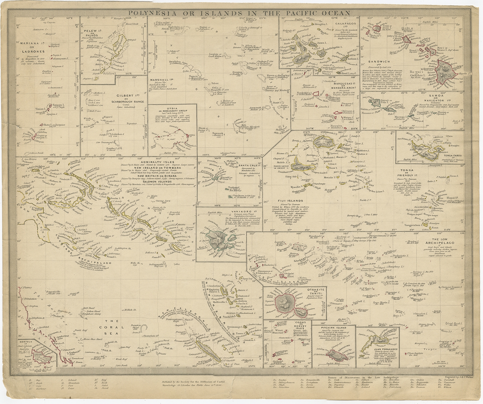 |
Antique Map of Polynesia by Walker (1840) $ 91.43 Availability: in stock Condition : Fair, age-related toning. Few tears, slightly affecting image. Please study image carefully. Date : 1840 Overall size : 40.5 x 33.5 cm. Image size : 39.5 x 31 cm. Description: Antique map titled 'Polynesia or Islands in the Pacific Ocean'. This map depicts various islands including the Lousiade Archipelago, Tahiti, Pitcairn Island, Juan Fernandez, The low Archipelago, Tonga or Friendly Islands, Vanikoro, SantaCruz, the Admiralty Isles, Salomon Islands, Samoa, Sandwich and the Ladrones. Artists and Engravers: Published by the Society for the Diffusion of Useful Knowledge, 1840. Engraved by J. & C. Walker. |
|