See our ratings  Add this shop to my favorites  |
||
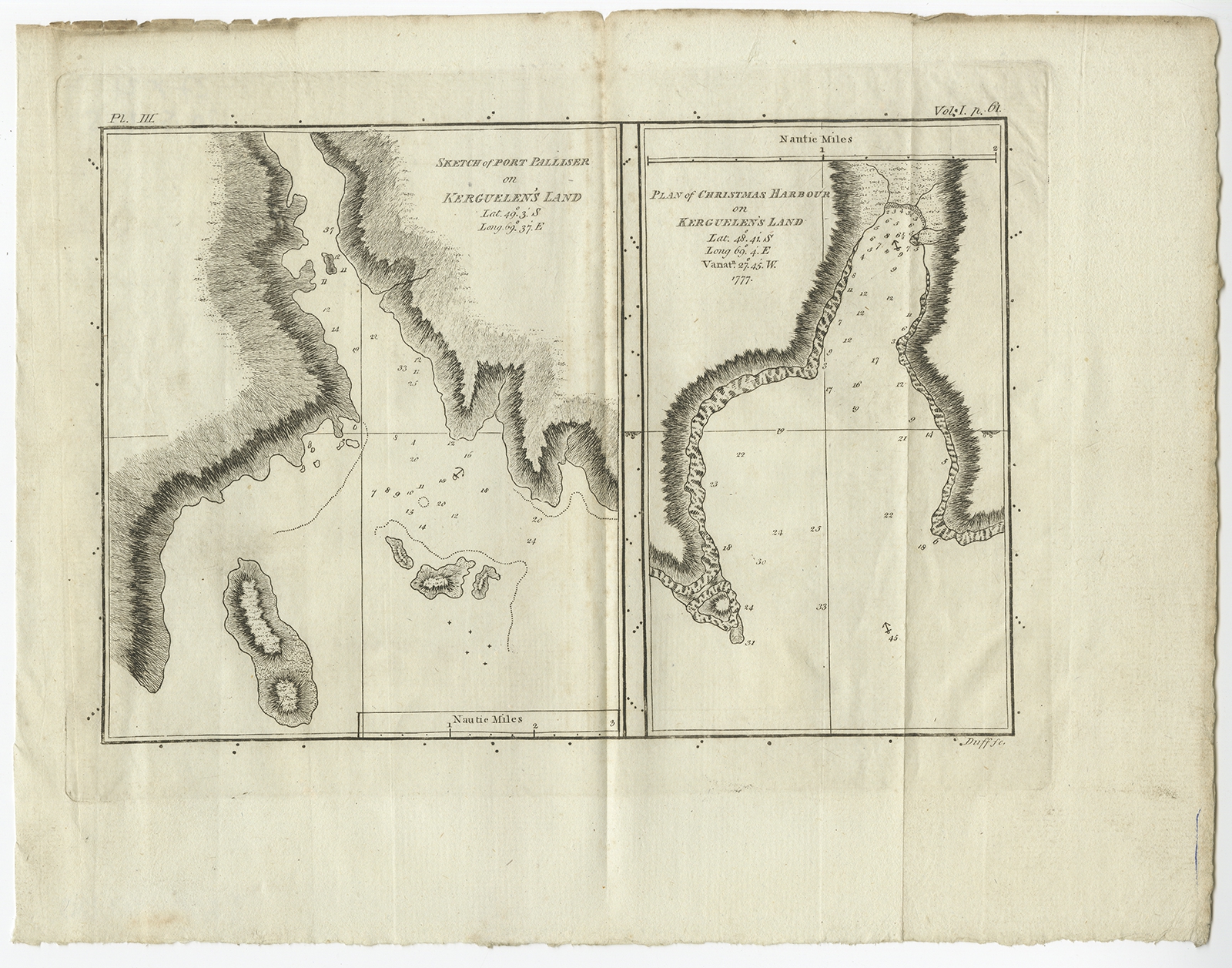 |
Antique Map of Port Pallisers & Kersmis by Cook (c.1781) $ 163.00 Availability: in stock Condition : Good, some wear and age-related toning. Please study image carefully. Date : c.1781 Overall size : 27 x 21 cm. Image size : 20.5 x 14.5 cm. Description: Antique map Kerguelen titled 'Sketch of Port Palliser on Kerguelen's Land (..)'. Antique map of Port Pallisers & Kersmis, Kerguelen or Desolation Islands. Originates from an edition of Cook's Voyages. Artists and Engravers: Engraved by Duff. |
|