See our ratings  Add this shop to my favorites  |
||
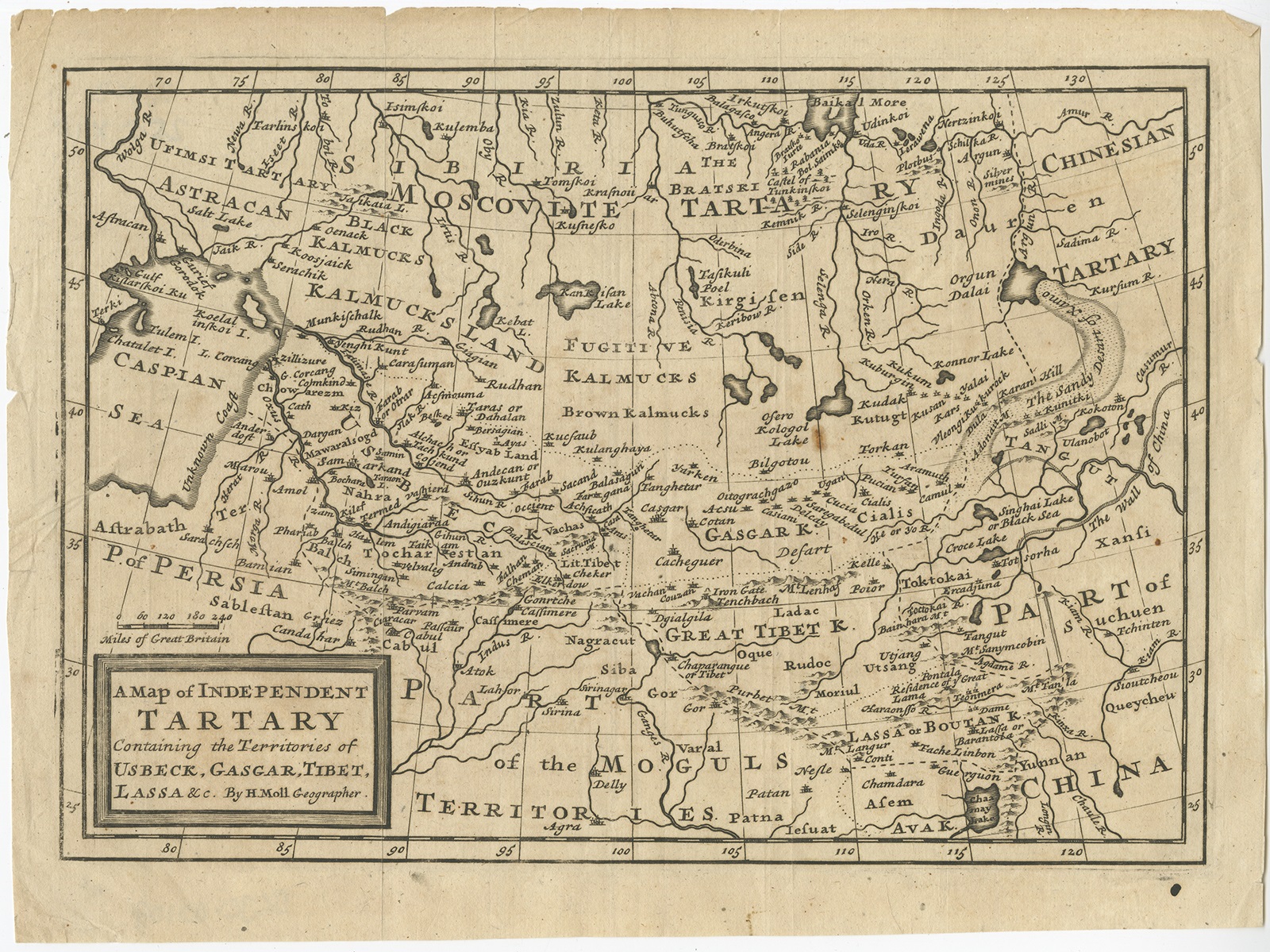 |
Antique Map of Persia and surroundings by Moll (c.1717) $ 411.91 instead of Availability: in stock Condition : Very good, few marginal tears and small spots. Please study image carefully. Date : c.1717 Overall size : 28 x 21 cm. Image size : 25.5 x 18 cm. Description: Antique map titled 'A Map of Independent Tartary, containing the territories of Usbeck, Gasgar, Tibet, Lassa & c'.Old map depicting east of the Caspian Sea with parts of Persia, Siberia, the Mogul territories and on to western China. This map originates from 'Atlas geographus, or, A Compleat system of geography, ancient and modern'. Artists and Engravers: Herman Moll (1654 - 1732), was a London cartographer, engraver, and publisher. |
|