See our ratings  Add this shop to my favorites  |
||
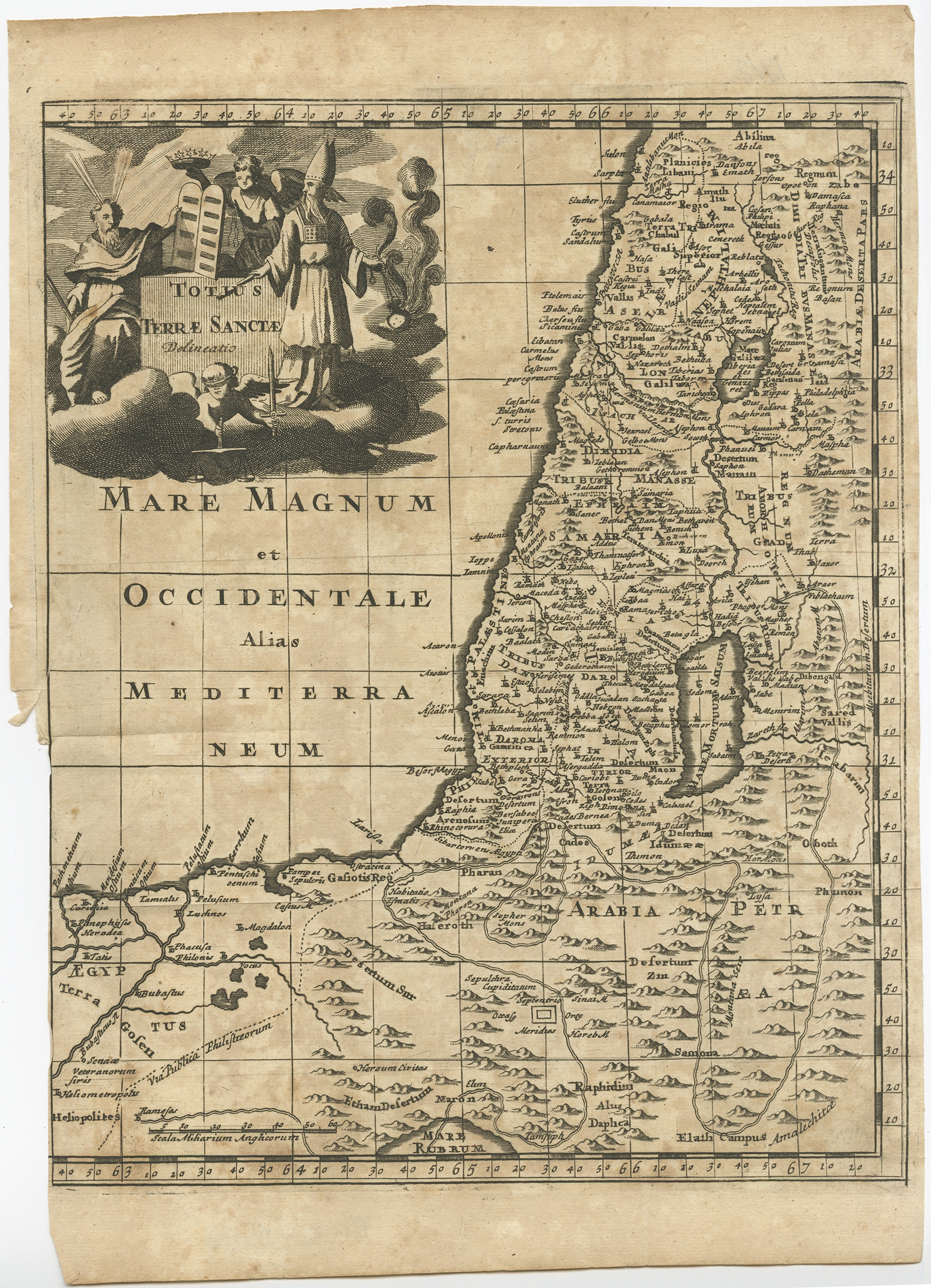 |
Antique Map of the Holy Land (c.1710) $ 140.64 Availability: in stock Condition : Fair, age-related toning. Tear left margin, please study image carefully. Date : c.1710 Overall size : 21 x 30 cm. Image size : 20.5 x 26 cm. Description: Antique map titled 'Totius Terrae Sanctae Delineatio'. Map of the Holy Land extending to Egypt and showing the route of the Children of Israel in their exodus from Egypt to the Promised Land. The large title cartouche shows Moses with the Commandments, Aaron, an angel, and a cherub in a cloud background. Artists and Engravers: Made by or after P. Cluver. |
|