See our ratings  Add this shop to my favorites  |
||
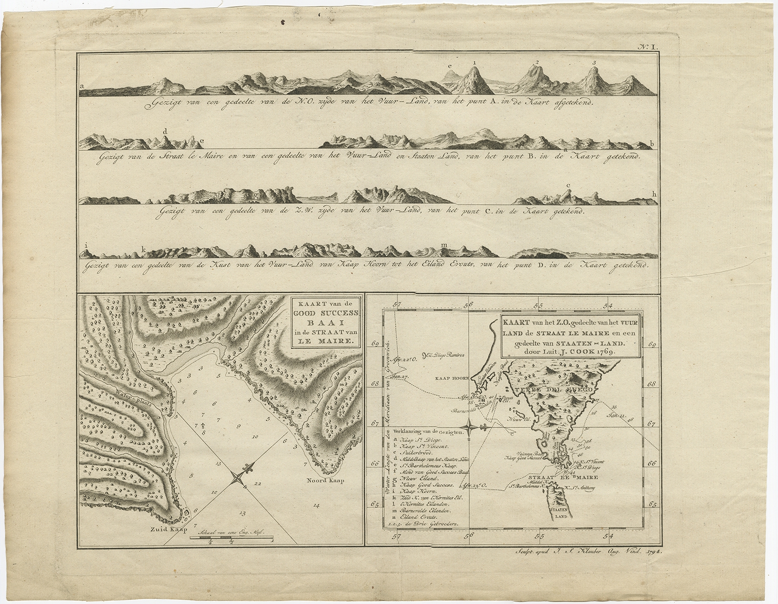 |
Antique Map of the Strait of Le Maire by Cook (1803) $ 741.44 instead of Availability: in stock Condition : Good, general age-related toning and some foxing. Please study image carefully. Date : 1803 Overall size : 46 x 35.5 cm. Image size : 35 x 29.5 cm. Description: Antique map titled 'Kaart van de Good Success Baai in de Straat van Le Maire (..)'. Antique map of the Strait of Le Maire between Terra Fuego and Staten Island. On top, various coastal view of the Strait of Le Maire. Originates from 'Reizen Rondom de Waereld door James Cook (..)'. Artists and Engravers: Translated by J.D. Pasteur. Published by Honkoop, Allart en Van Cleef. |
|