See our ratings  Add this shop to my favorites  |
||
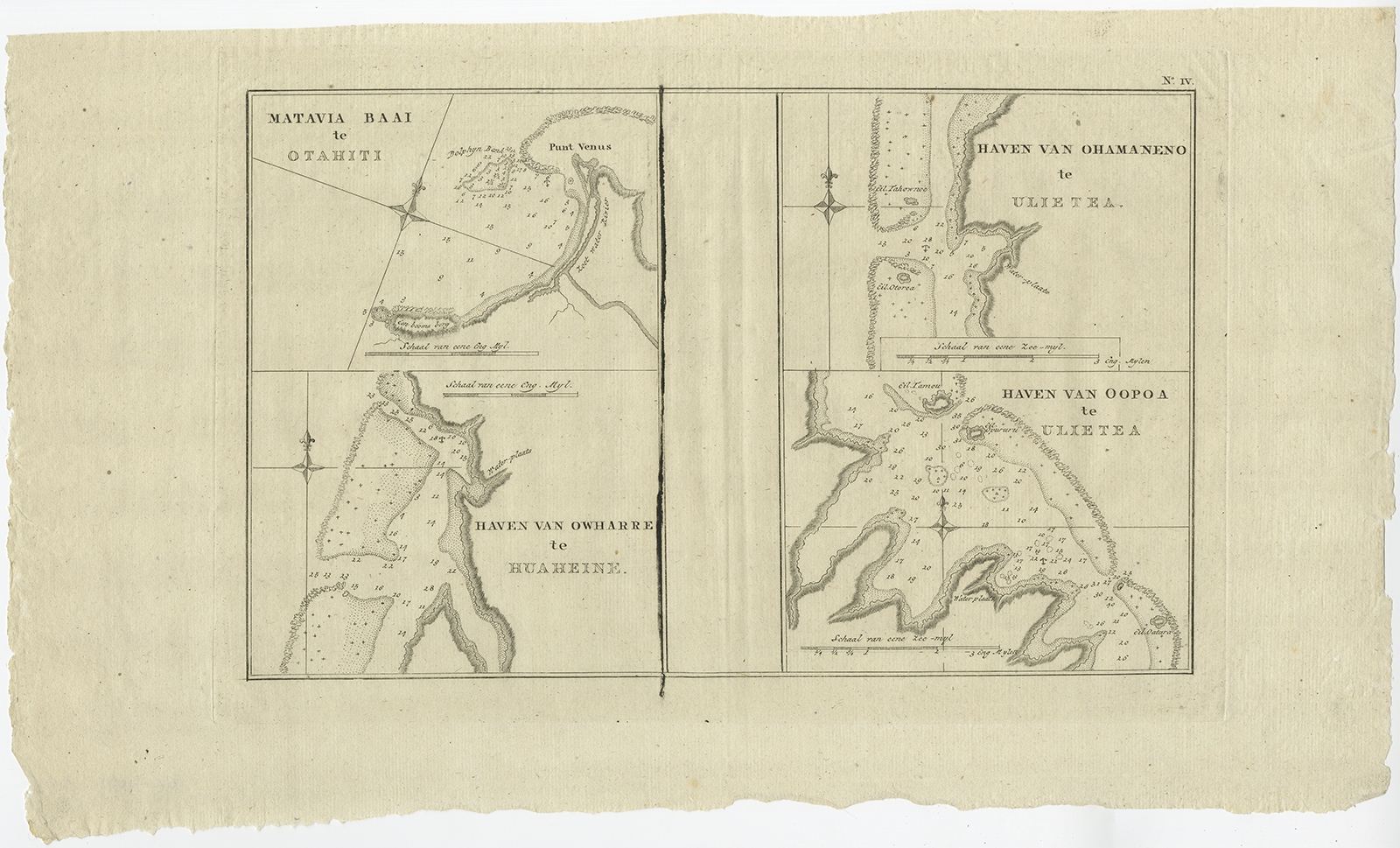 |
Antique Map of the Harbors of Matavai by Cook (1803) $ 328.94 instead of Availability: in stock Condition : Good, general age-related toning. Please study image carefully. Date : 1803 Overall size : 48 x 28 cm. Image size : 33 x 21 cm. Description: Antique map Oceania titled 'Matavia Baai te Otahiti (..)'. Antique map depicting the harbors of Matavai on the north coast of Tahiti; Ohamaneno and Oopoa on Raiatea (Ulieta on the chart) and Owharre on the island of Huahine. Originates from 'Reizen Rondom de Waereld door James Cook (..)'. Artists and Engravers: Translated by J.D. Pasteur. Published by Honkoop, Allart en Van Cleef. |
|