See our ratings  Add this shop to my favorites  |
||
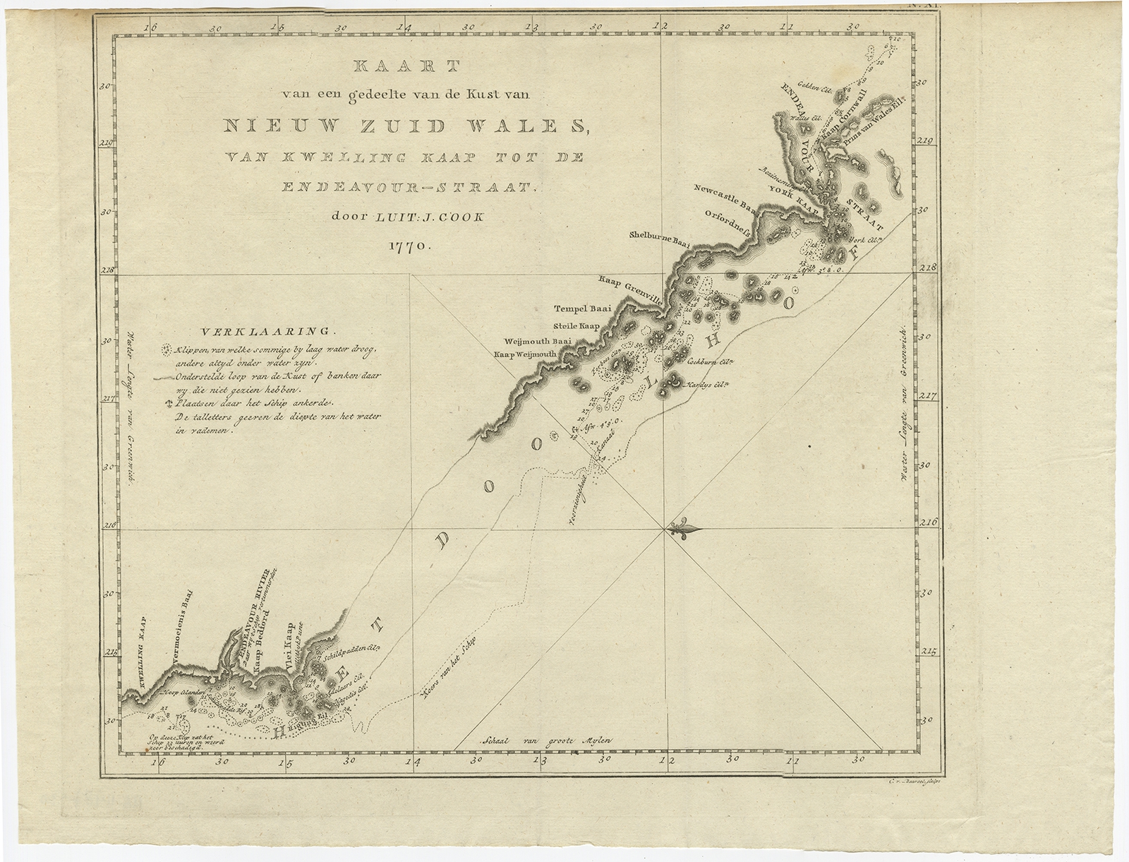 |
Antique Map of the Northeast Coast of Australia by Cook (1803) $ 1,047.43 instead of Availability: in stock Condition : Very good, general age-related toning. Please study image carefully. Date : 1803 Overall size : 42.5 x 32 cm. Image size : 32 x 29 cm. Description: Antique map Australia titled 'Kaart van een gedeelte van de Kust van Nieuw Zuid Wales van Kwelling Kaap tot de Endeavour-Straat door Luit. J. Cook'. A chart of the northeast coast of Australia from the northern extremity of Cape York peninsula with Endeavour Strait to the Endeavour River and present day Cooktown. Originates from 'Reizen Rondom de Waereld door James Cook (..)'. Artists and Engravers: Translated by J.D. Pasteur. Published by Honkoop, Allart en Van Cleef. |
|