See our ratings  Add this shop to my favorites  |
||
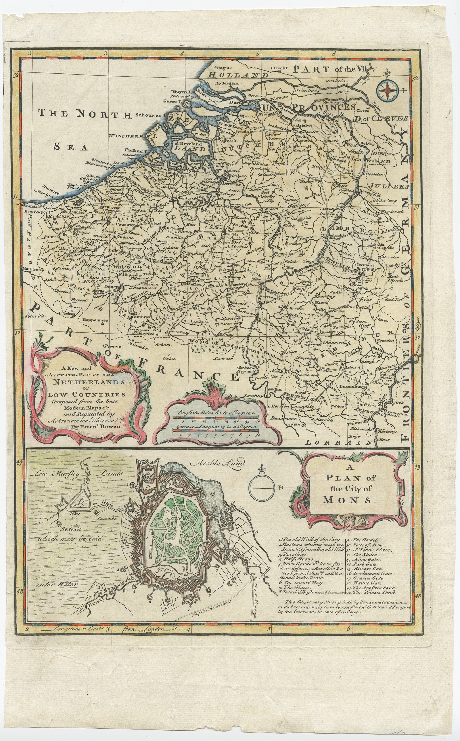 |
Antique Map of the Netherlands and Belgium by Bowen (1747) $ 254.80 Availability: in stock Condition : Good, minor defects and repairs (mainly outside image border). Please study image carefully. Date : 1747 Overall size : 24 x 39 cm. Image size : 22 x 32 cm. Description: Antique map Belgium titled 'A New and Accurate Map of the Netherlands or Low Countries'. Detailed map of South of the Netherlands and Belgium. With large inset of the city of Mons, Bergen. Originates from 'A Complete System of Geography'. Artists and Engravers: Emanuel Bowen (1694?-1767) was a British engraver and print seller. |
|