See our ratings  Add this shop to my favorites  |
||
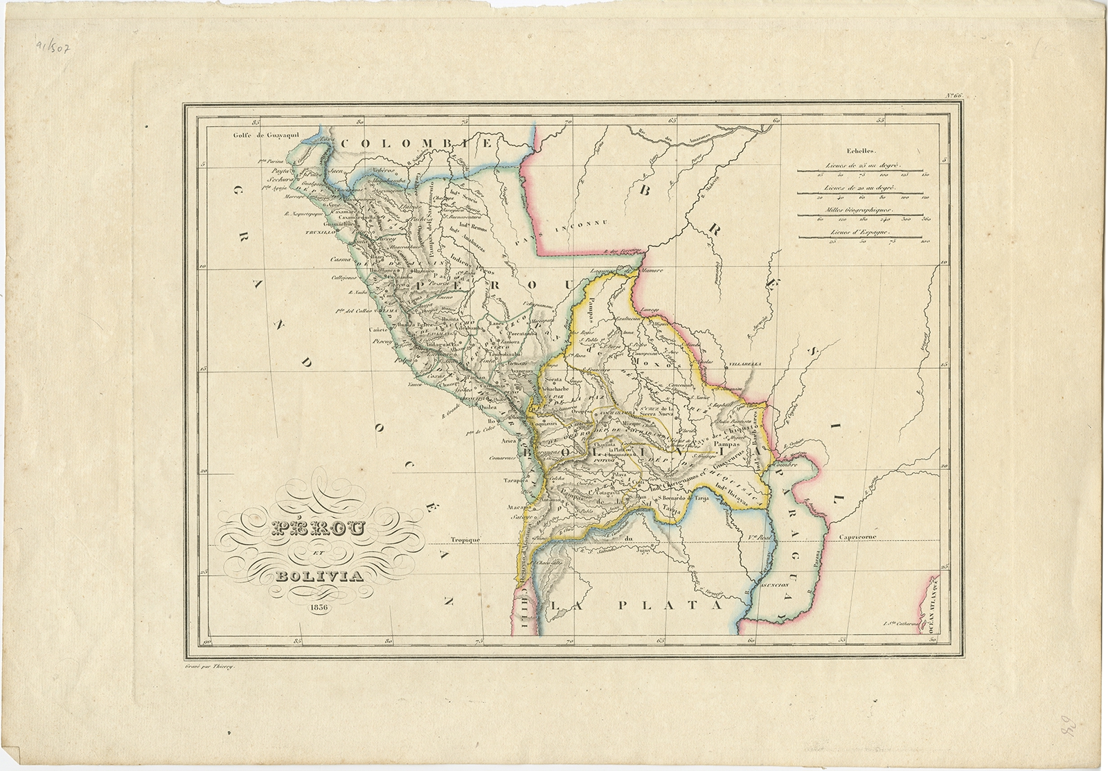 |
Antique Map of Peru and Bolivia by Thierry (1836) $ 400.14 instead of Availability: in stock Condition : Very good, general age-related toning. Please study image carefully. Date : 1836 Overall size : 42.5 x 29.5 cm. Image size : 30 x 21.5 cm. Description: Antique map titled 'Pérou et Bolivia'. Decorative map of Peru and Bolivia with outline coloring. Originates from 'Atlas Complet Du Precis De La Geographie Universelle de M. Malte-Brun'. Artists and Engravers: Engraved by Thierry. |
|