See our ratings  Add this shop to my favorites  |
||
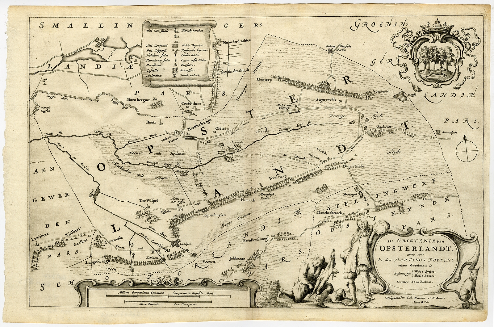 |
Antique Map of the region of Opsterland by Schotanus (1664) $ 317.17 instead of Availability: in stock Condition : Good, given age. Edge with an occasional tiny tear. A few minor light creases. Original folds as issued. General age-related toning and/or occasional minor defects from handling. Please study image carefully. Date : 1664 Overall size : 46.7 x 31 cm. Image size : 44.4 x 28.2 cm. Description: Antique map titled 'De Grietenie van Opsterlandt : waer over d'e. heer Martinus Fockens altans grietman is, bysitters syn Wybe Sytjes, Boele Broers, secretaris Saco Fockens.' Detailed and decorative regional map of the Grietenij of Opsterland, Friesland, The Netherlands. Multiple cartouches, key and coat of arms. This antique map originates from 'Beschrijvinge ende nieuwe caerten van de Heerlyckheydt van Frieslandt (…)', by Schotanus a Sterringa, first published in 1664. |
|