See our ratings  Add this shop to my favorites  |
||
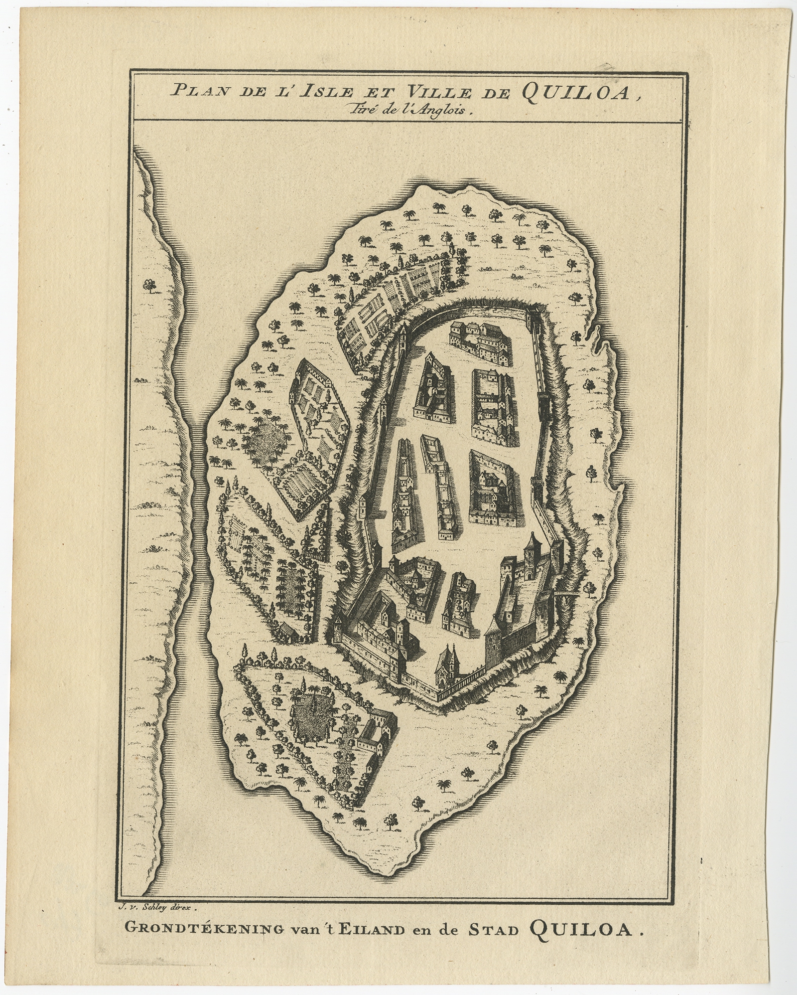 |
Antique Plan of Quiloa (Kilwa Kisiwani ) by Van Schley (1749) $ 494.30 Availability: in stock Condition : Very good, please study image carefully. Date : 1749 Overall size : 19.5 x 25 cm. Image size : 14 x 21 cm. Description: Antique print titled 'Plan de l'Isle et Ville de Quiloa, Grondtékening van 't Eiland en de Stad Quiloa'. This bird's-eye view show the East African island of Quiloa, now known as Kilwa Kisiwani in Tanzania. The map shows the fort, settlements, and gardens of the island. It dates to a few decades before the Arab conquest of the island, after which the French built a fort at its northern end. This print originates from 'Historische beschryving der reizen, of Nieuwe en volkoome verzameling van de aller-waardigste en zeldsaamste Zee- en Landtogten' by P. de Hondt. Artists and Engravers: Jakob van der Schley (1715-1779) was a Dutch draughtsman and engraver, who studied under Bernard Picart. Jacques-Nicolas Bellin (1703-1772) was a French hydrographer, geographer and member of The Philosophes. His career, spanning over 50 years, caused an enormous output in maps, particular of maritime interest. |
|