See our ratings  Add this shop to my favorites  |
||
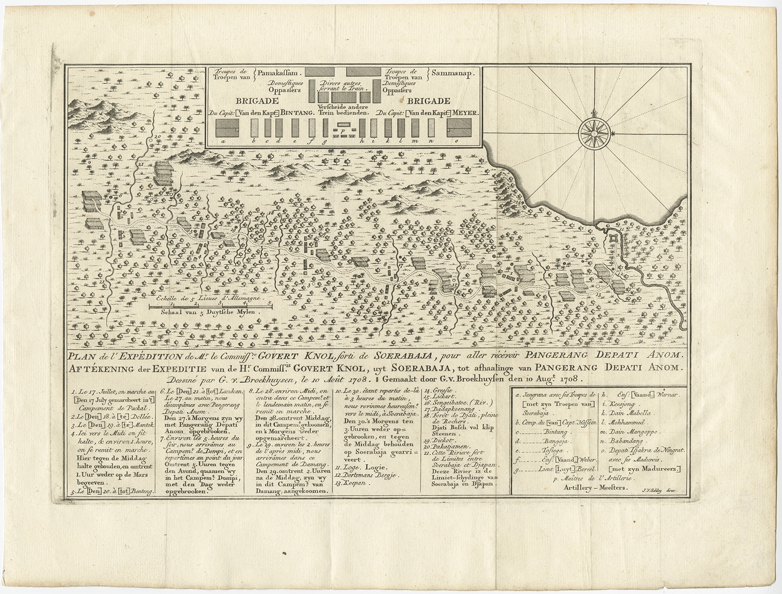 |
Antique Map of the Expedition of Govert Knol by Van Schley (1765) $ 140.64 Availability: in stock Condition : Very good, please study image carefully. Date : 1765 Overall size : 36 x 27.5 cm. Image size : 29.2 x 20.2 cm. Description: Antique map titled 'Plan de l' expédition de Mr. le Commiss.re Govert Knol, forti de Soerabaja, pour aller récévoir Pangerang Depati Anom. / Aftékening der Expeditie van de H.r Commiss.is Govert Knol, uyt Soerabaya, tot afhaalinge van Pangerang Depati Anom'. Map showing the expedition of Commissioner Govert Knol from Surabaya to Pangerang, Indonesia. This map originates from 'Historische beschryving der reizen (..)' published 1765. Artists and Engravers: Jakob van der Schley (Amsterdam 1715-1779) was a Dutch draughtsman and engraver. He studied under Bernard Picart and became heavily influenced by his style. |
|