See our ratings  Add this shop to my favorites  |
||
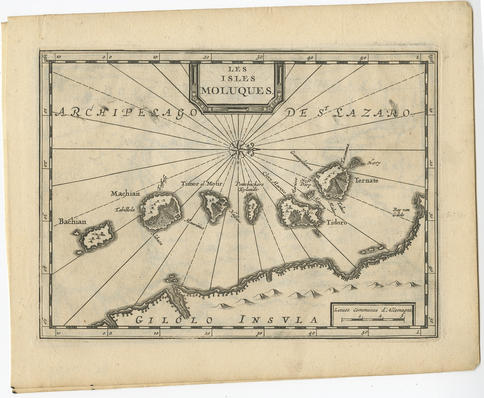 |
Antique Map of the Maluku Islands by Van der Aa (1714) $ 233.61 instead of Availability: in stock Condition : Very good, please study image carefully. Date : 1714 Overall size : 23.3 x 18.5 cm. Image size : 19.7 x 14.3 cm. Description: Antique Map Moluccas titled 'Les Isles Moluques'. Rare map of the Spice Islands made after a map engraved by Pieter van den Keere and published in the 1628 edition of the Mercator Atlas Minor. This edition originates from 'Atlas Soulage'. The cartouche and compass rose are revised and the title is in French. Artists and Engravers: Pieter van der Aa (Leiden 1659-1733) was a Dutch publisher best known for preparing maps and atlases. |
|