See our ratings  Add this shop to my favorites  |
||
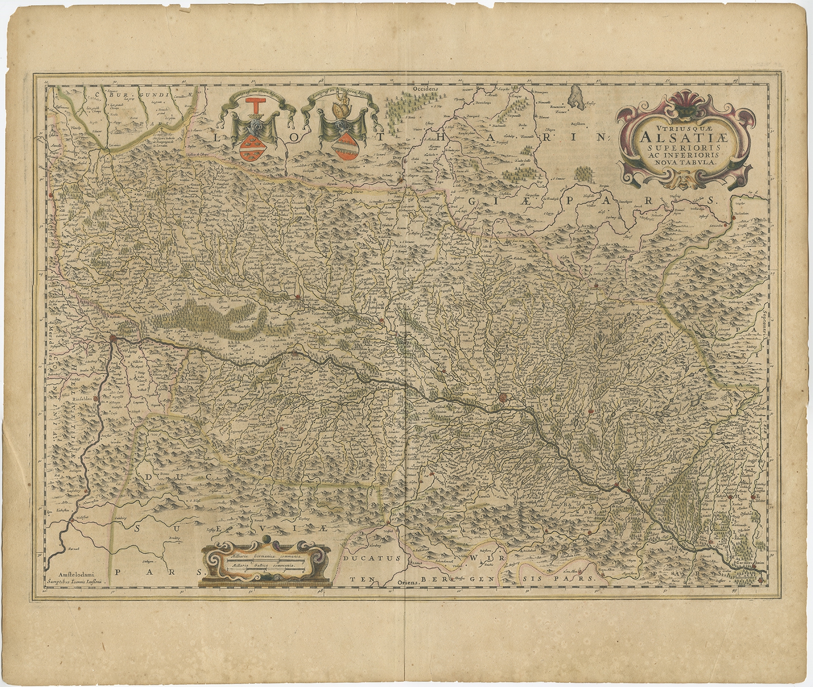 |
Antique Map of the Alsace region of France by Janssonius (c.1650) $ 423.68 instead of Availability: in stock Condition : Fair, age-related toning. Tear at both lower left and right corner, some smaller marginal tears. Original, contemporary hand coloring. Dutch text on verso. Please study image carefully. Date : c.1650 Overall size : 59 x 50 cm. Image size : 54.5 x 39 cm. Description: Antique map titled 'Utriusquae Alsatiae Superioris Ac Inferioris Nova Tabula'. Map of the Alsace region (France) including the Rhine from Phillipsburg to south of Basle. Two decorative cartouches and two coats of arms. Artists and Engravers: Johannes Janssonius (Jansson), ( 1588- 1664) Amsterdam was born in Arnhem, the son of Jan Janszoon the Elder,a publisher and bookseller. |
|