See our ratings  Add this shop to my favorites  |
||
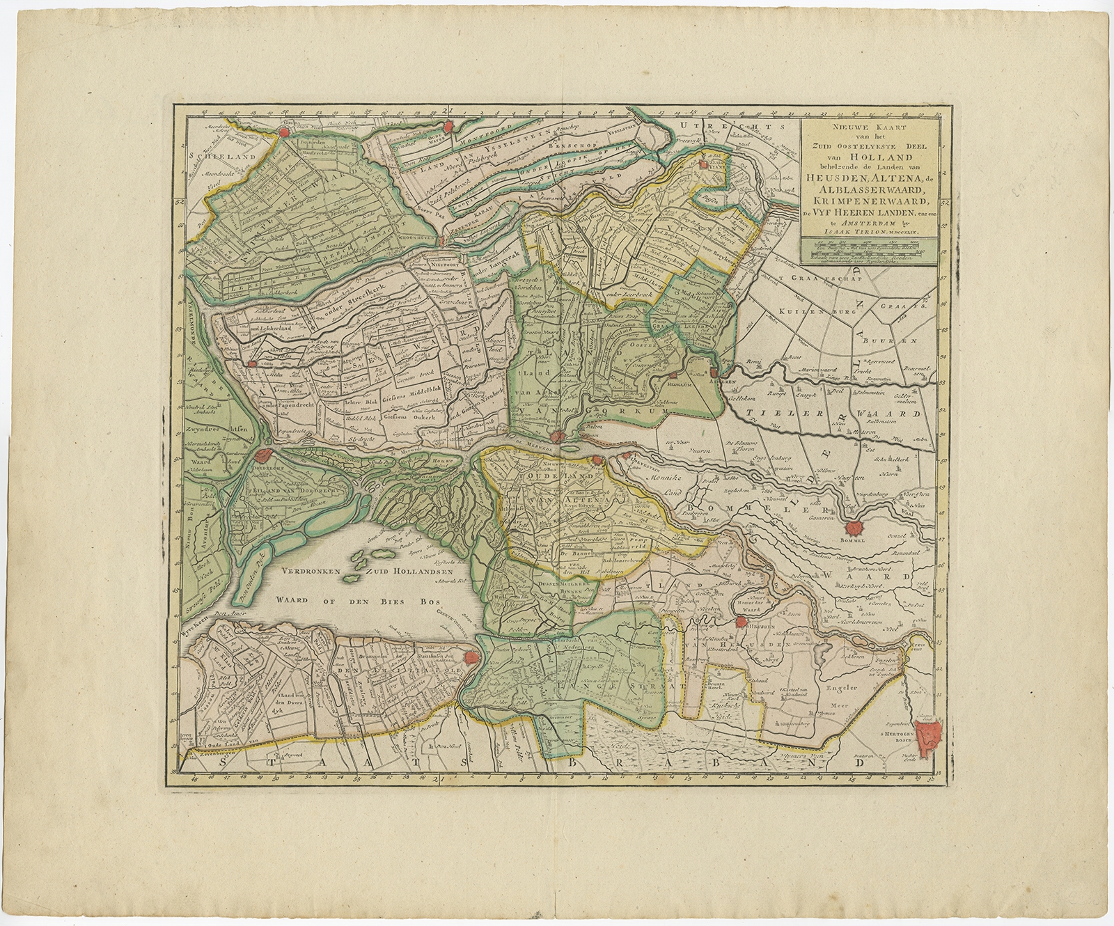 |
Antique Map of the 'Biesbosch' region by Tirion (1749) $ 381.90 instead of Availability: in stock Condition : Very good, general age-related toning. Original, contemporary hand coloring. Please study image carefully, Date : 1749 Overall size : 52.5 x 43.5 cm. Image size : 37 x 32.5 cm. Description: Antique map titled 'Nieuwe Kaart van het Zuid Oostelykste deel van Holland behelzende de Landen van Heusden, Altena, de Alblasserwaard, Krimpenerwaard, de Vyf Heeren Landen enz. enz'. Detailed map of the 'Biesbosch' region, The Netherlands. Covering the area of Gouda, IJsselstein, s'Hertogenbosch, Zevenbergen, Dordrecht. Artists and Engravers: Isaak Tirion, a Dutch publisher in Amsterdam, was born 1705. He produced serveral Atlases and Dutch town plans. The maps mainly based on those of Guillaume de l'Isle. He died in 1765. |
|