See our ratings  Add this shop to my favorites  |
||
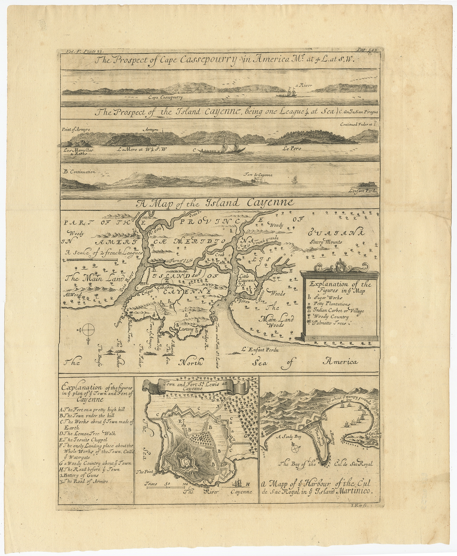 |
Antique Map of Cayenne and Cassepouri by Kip (c.1730) $ 447.22 Availability: in stock Condition : Good. General age-related toning. Please study image carefully. Date : c.1730 Overall size : 34.5 x 42 cm. Image size : 25.5 x 36 cm. Description: Antique map titled 'A Map of the Island Cayenne (..)’. A set of interesting copper engravings of Cayenne and Cassepouri, French Guinea, South America, and Martinique in the West Indies. The map of Cayenne, home of Cayenne pepper, has a key of symbols identifying the sugar works, petty plantations, indian carbet or village, woody country and palmetto trees. The plan of Fort Lewis, Cayenne also has a lettered key including; A. the fort on a pretty high hill, d.the lemon tree walk, f. the only landing place about the whole works of the town call'd ye watergate, etc. Artists and Engravers: Born in the Netherlands, Johannes Kip settled in England around 1690. He was a topographical engraver most famous for his depictions of country houses in the book; ‘Britannia Illustrata’ on which he collaborated with Leonard Knyff (1707). Although this is his most well known work, he was a prolific artist who worked on many other important projects and commissions, including the illustrations for Churchill’s ‘Voyages’. |
|