See our ratings  Add this shop to my favorites  |
||
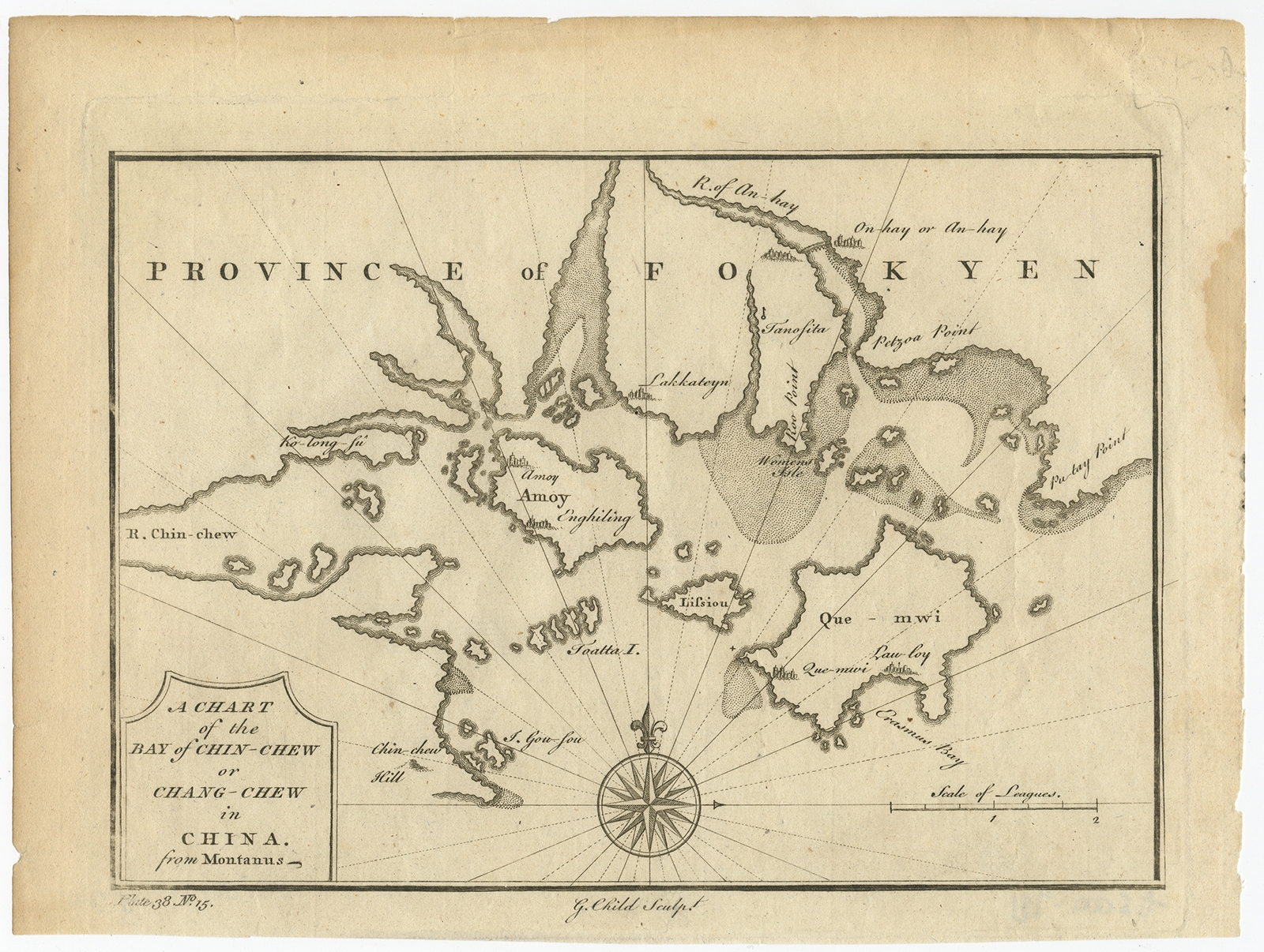 |
Antique Map of the Bay of Chin Chew by Child (1747) $ 199.48 instead of Availability: in stock Condition : Good, given age. Age related toning. Stain at upper right next to map. Please study scan carefully. Date : 1747 Overall size : 23.8 x 17.9 cm Image size : 20.4 x 14.8 cm Description: Antique map titled 'A Chart of the Bay of Chin-Chew or Chang-Chew in China'. Small but very early and interesting map, engraved by G. Child for 'The Universal Traveller', by Thomas Salmon. Covers that part of the coastline from Pu-tay Point, down to the Chin Chew river, with Ko-long-fu, Lakkateyn, Tano-fita, Roo Point, Womends Isle, Petzoa Point and the An-hay river with On-hay or An-hay town and its great bridge shown. Also, the great island of Amoy, Lifsiou, Que Mwi, Toatta and Gou-fou et al to the far South. The compass is in the lower central position, radiating out across the whole map. Artists and Engravers: Engraver: G. Child. Author: T. Salmon |
|