See our ratings  Add this shop to my favorites  |
||
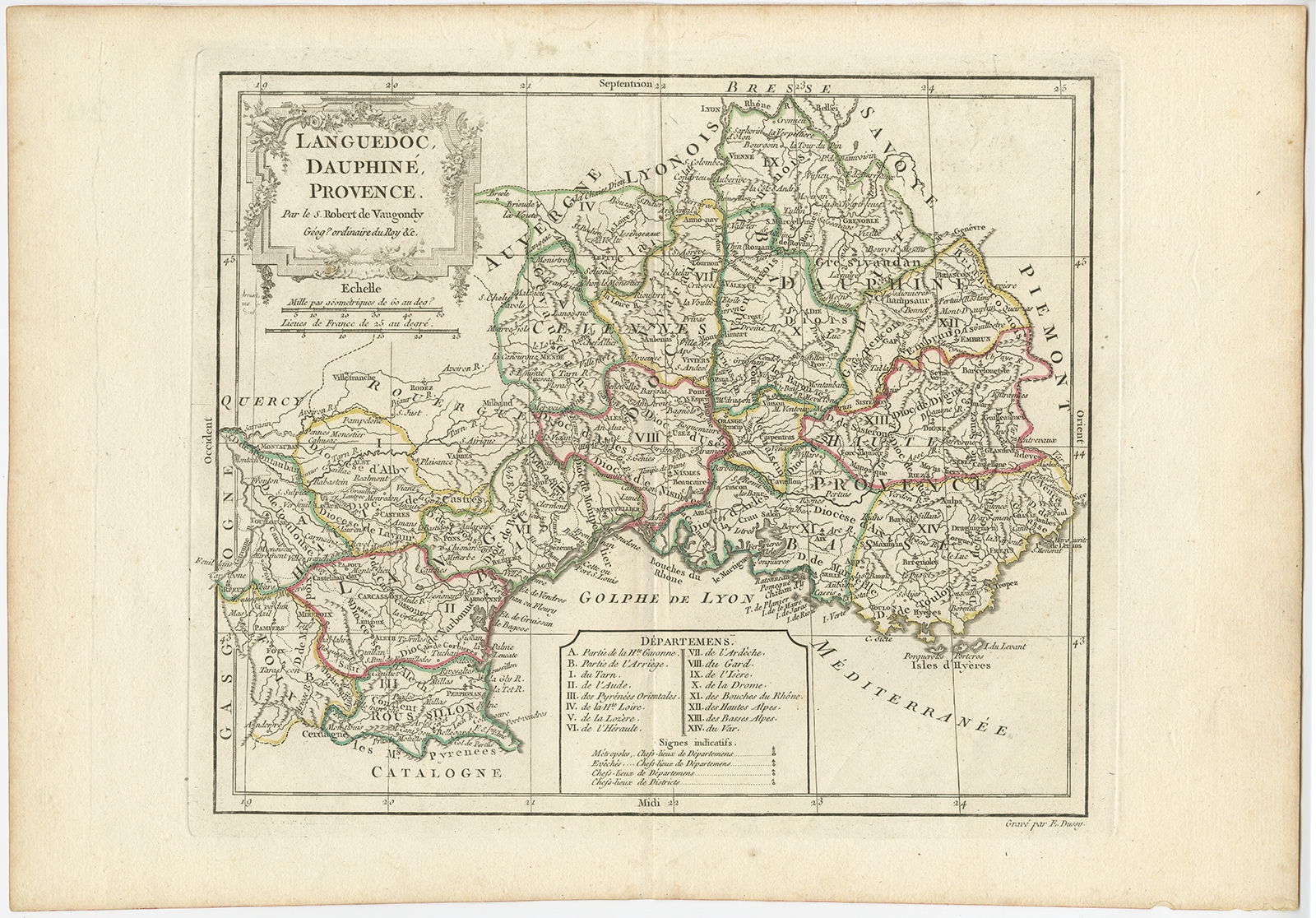 |
Antique Map of Southeastern France by Vaugondy (c.1790) $ 447.22 Availability: in stock Condition : Very good, contemporary hand coloring. Please study image carefully. Date : c.1790 Overall size : 41.5 x 29 cm. Image size : 29 x 24 cm. Description: Antique map titled 'Languedoc, Dauphiné, Province'. Beautiful antique map of Southeastern France with decorative cartouche. Map includes topographical detail as well as a reference to the departments at the time of publication. Artists and Engravers: Gilles Robert de Vaugondy (1688-1766), also known as Le Sieur or Monsieur Robert, and his son, Didier Robert de Vaugondy (c.1723-1786), were leading cartographers in France during the 18th century. |
|