See our ratings  Add this shop to my favorites  |
||
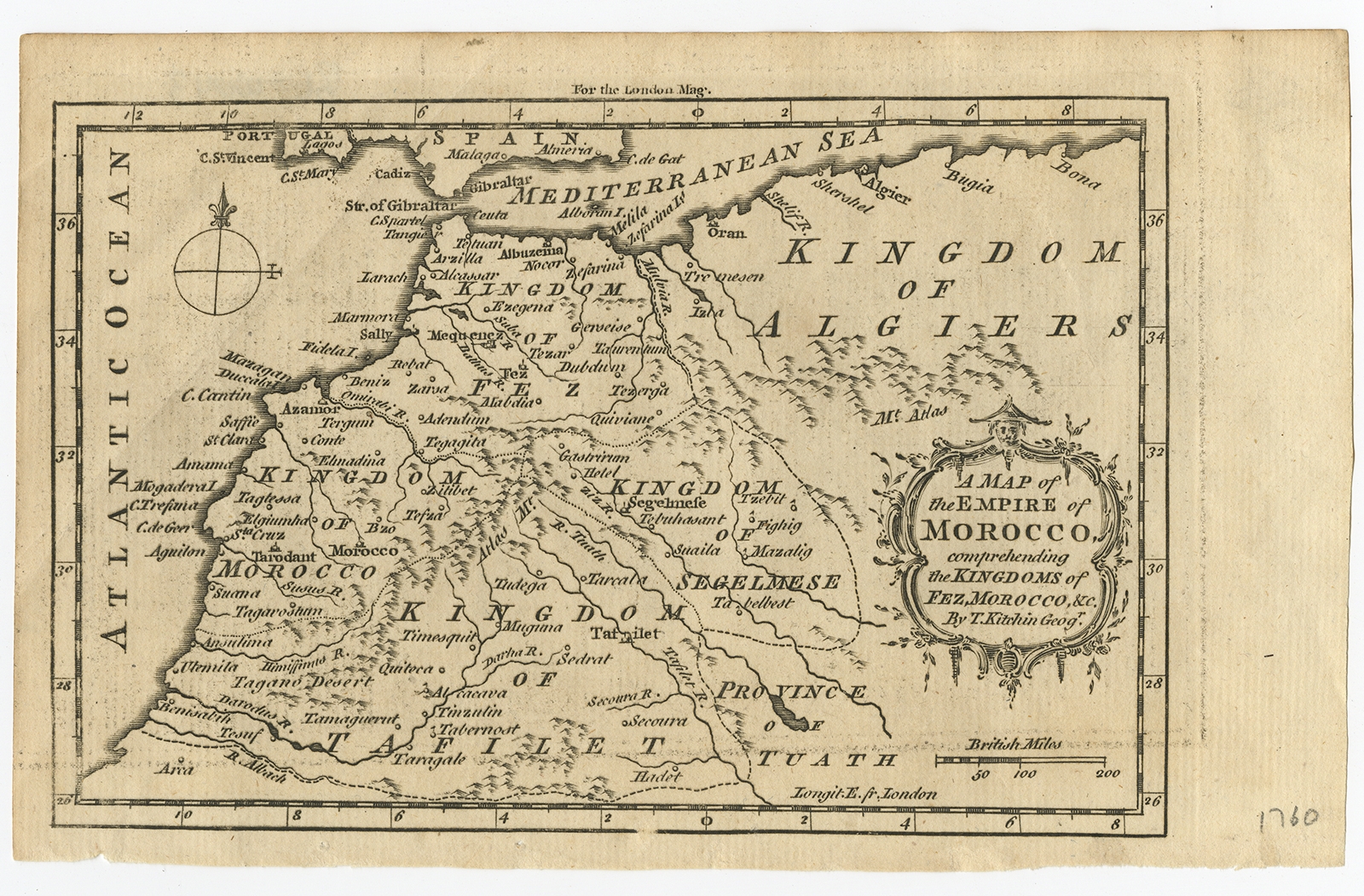 |
Antique Map of the Empire of Morocco by Kitchin (c.1760) $ 211.84 instead of Availability: in stock Condition : Good, some age related toning. Original plate mark visible. Please study scan carefully. Date : c.1760 Overall size : 20.5 x 13 cm Image size : 17.2 x 11.7 cm Description: Antique map titled 'A Map of the Empire of Morocco Comprehending the Kingdoms of Fez, Morocco'. Original antique map of the kingdoms of Fez, Algiers, Segelmese, Tafilet and Morocco. Towns, rivers and mountains are indicated. This map originates from the 'London Magazine' circa 1760. Artists and Engravers: Thomas Kitchin (or Thomas Kitchen (1718 - 1784) was an English engraver and cartographer, who became hydrographer to the king. He was also an author, who wrote about the history of the West Indies. |
|