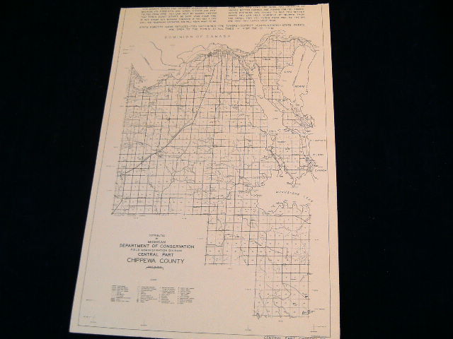
This map was distributed the Michigan Department of Conservation and is beautifully detailed. This is the central part of Chippewa county. It measures about 11 by 16 inches overall (about 28 by 41 cm.), and is in excellent condition. This vintage map shows many topographical features like rivers, lakes, creeks, islands, springs, wells, peaks, as well as townships, cities, villages and post office towns, plus paved roads, graveled roads, dirt roads (distinguished between "good" and "poor"), trails, fire breaks, railroads, abandoned railways, dams, mines and quarries. It also shows some man-made structures such as churches, schools, cemeteries, farms, air strips, hunting, fishing and tourist camps, golf courses, train stations, etc. The scale is about three miles to the inch.
This guaranteed genuine vintage map was printed on a single sheet of stock, and is blank on the reverse side, highly suitable for framing. It would make an excellent addition to your collection.
Please feel free to e-mail me if you have any questions. We are always happy to combine items to help you save on shipping. Additional similar maps will ship with this for $.25 each.
Shipping for this map anywhere in the US is $ 2.75
Shipping for this map to Canada is $ 3.25
Shipping for this ad anywhere else in the world is $ 5.00
Please check my other auctions and E-Bay store for more vintage treasures..
|